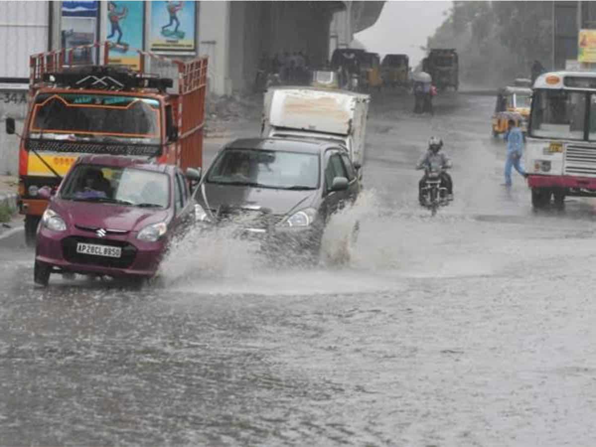
New Delhi: The country received 27 per cent more rainfall than normal in August, the fourth-highest amount in the last 120 years, the India Meteorological Department (IMD) said.
India Meteorological Department
The overall rainfall recorded in India from June 1 to August 31 was 10 per cent more than normal, the IMD said on Monday. The official rainfall season in the country is from June 1 to September 30.
“August has recorded 27 per cent more rainfall than normal,” R K Jenamani, scientist with IMD’s national weather forecasting centre, said.
In its forecast for August last month, the IMD had predicted rainfall of 97 per cent of the Long Period Average (LPA) with an error margin of plus or minus 9 per cent. Monsoon in the range of 96-104 per cent of the LPA is considered normal.
“Rainfall recorded in August 2020 is the fourth highest in the last 120 years and highest in 44 years,” Jenamani added.
This is also one of the rainiest months of August recorded. The August of 1926 saw 33 per cent more rainfall than normal, the highest precipitation recorded so far in the month; 1976 recorded 28.4 per cent more rainfall than normal, while the August of 1973 recorded 27.8 per cent than normal. This year saw 27 per cent rainfall.
Mahesh Palwat
Mahesh Palwat, vice president, Skymet Weather, said due to formation of five low pressure areas in Bay of Bengal in August, the month recorded excess rainfall.
A low pressure area is a cyclonic circulation. It is also the first stage of a cyclone. However, it is not necessary that every low pressure develops into a cyclonic storm.
Jenamani said five low pressure areas formed over Bay of Bengal brought heavy rains over central and north India. Of the five, four developed into a well-marked low pressure area.
Several parts of the country witnessed floods last month due to incessant rainfall last month.
The first low pressure area
Jenamani said the first low-pressure area formed between August 4-10 off the Odisha coast. It moved across central India and Gujarat and entered into the north Arabian Sea and dissipated over the Oman coast.
The second low pressure area
The second low-pressure area formed between August 9-11 off the Andhra Pradesh-Odisha coast. It moved across Chhattisgarh to northeast Madhya Pradesh. Its remnant moved to northwest India, causing floods in Jaipur on August 14, he said.
The third low pressure area
The third one was between August 13-18. It moved across Chhattisgarh to northeast Madhya Pradesh, but its remnant as circulation moved over to northeast Rajasthan and south Punjab during August 18-20. This caused a major rain spell over northwest India. It was at the same time that the Delhi-NCR recorded flooding due to heavy rainfall.
The fourth low pressure area
The fourth one formed between August 19-26 and it moved across central India to southwest Rajasthan and adjoining south Pakistan. The weather system also caused floods over Odisha on August 20-21, over Telangana including Warangal and part of Hyderabad on August 21, west Madhya Pradesh on August 22 and south Rajasthan and Gujarat on August 23 and 24.
The last low pressure area
The last and the fifth system also formed between August 24-31.
June had recorded 17 per cent more rainfall than normal while July ended with a 10 per cent rainfall deficiency.
The IMD had predicted that July will get rainfall that is 103 per cent of the Long Period Average (LPA), which falls in the “normal” category. The LPA rainfall over the country for the 1961-2010 period is 88 centimetres.
Long range forecast
In its Long Range Forecast for rainfall in the second half (August-September) of the 2020 Southwest Monsoon released last month, the IMD said August was likely to receive rainfall that is 97 per cent of the LPA with an error margin of plus/minus nine per cent.
“Quantitatively, the rainfall over the country as a whole during the second half of the season is likely to be 104 per cent of the LPA with an error margin of plus/minus eight per cent,” it had said.
The northwest division
The northwest division of the IMD has an overall 9 per cent deficiency. It comprises Rajasthan, Uttar Pradesh, Himachal Pradesh, Uttarakhand, Punjab, Haryana and the Union territories of Chandigarh, Delhi, Jammu and Kashmir and Ladakh. Jammu and Kashmir and Ladakh have recorded deficient rainfall.
The central india division
The central India division received 21 per cent more rainfall so far. The division comprises Goa, Maharashtra, Gujarat, Madhya Pradesh, Chhattisgarh, Odisha and the Union territories of Dadra and Nagar Haveli and Daman and Diu. Gujarat has recorded large excess rainfall while Goa saw excess precipitation.
The south peninsula meteorological division
The south peninsula meteorological division of the IMD has received 20 per cent more rainfall than normal. The division covers Andhra Pradesh, Tamil Nadu, Telangana, Kerala, Karnataka and the Union territories of Andaman and Nicobar Islands, Lakshadweep and Puducherry. Andhra Pradesh, Telangana, Tamil Nadu have recorded excess rainfall.
The east and northeast India division
The east and northeast India division has also recorded 2 per cent more rainfall than normal. The division comprises West Bengal, Bihar, Jharkhand and the northeastern states. Nagaland, Manipur and Mizoram recorded deficient rainfall while Sikkim has witnessed large excess.