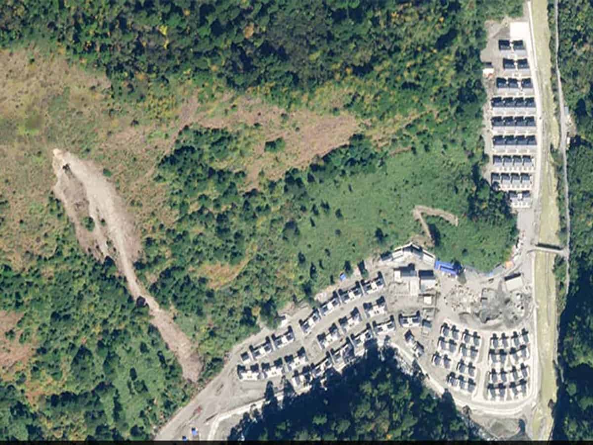
Satellite images show that China has constructed a village containing about 101 homes 4.5 kms into Indian territory in Arunachal Pradesh, NDTV reported.
Comparing satellite images from August 2019 and November 2020 that has been accessed by NDTV, a full-blown village is visibly evident in the area that is officially Indian territory. Experts that have analysed the images for NDTV have also corroborated the same.
While it is official Indian territory, China has had control of the area since 1959. However, the area had only seen the presence of military outposts till now.
The village is located on the eastern range of the Himalayas on the banks of River Tsari Chu. In Arunachal Pradesh this is the Upper Subansiri district.
The Indian Foreign Ministry has not denied the reports. “We have seen recent reports on China undertaking construction work along the border areas with India. China has undertaken such infrastructure construction activity in the past several years,” the MEA said in a statement.
“The government remains committed to the objective of creating infrastructure along the border areas for the improvement of livelihood of its citizens, including in Arunachal Pradesh,” the ministry added.
In November of 2020 (the same month the image was taken), BJP MP of Arunachal Pradesh Tapir Gai, had brought the issue of China’s encroachment in the Lok Sabha, while explicitly mentioning the Upper Subansiri district.
Experts believe that civilian settlements has dire implications for India’s stake on the encroached land and other border areas.
Sim Tack, a security analyst talking to Hindustan Times said that the construction would “strengthen its (China’s) territorial claims”.