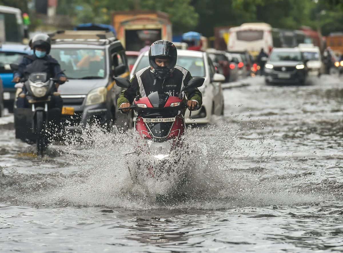
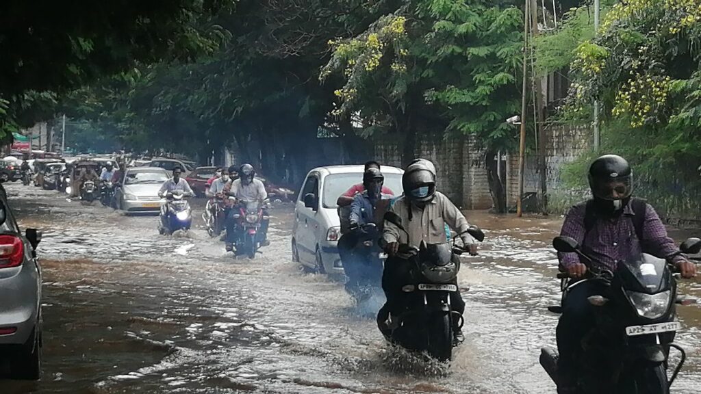
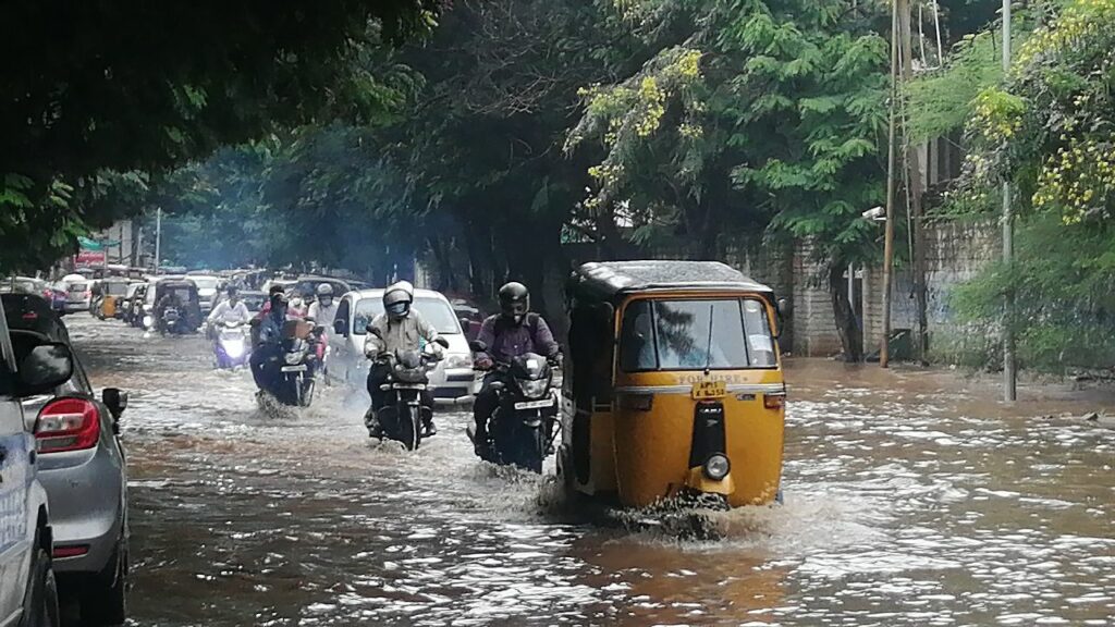
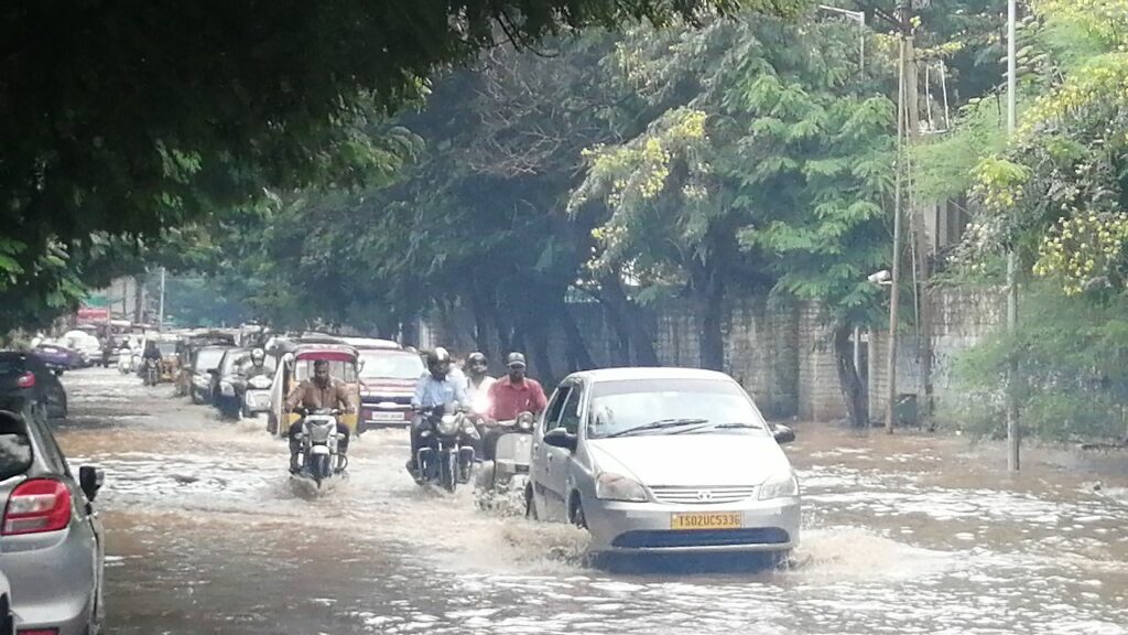
Hyderabad: The Greater Hyderabad Municipal Corporation (GHMC) sounded an alert after the Indian Meteorological Department predicted the possibility of very heavy rainfall from tonight till October 15. On Friday, an intensive rain threw life out of gear for a few hours, with the city’s well-marked low lying areas witnessed waterlogging.
The blinding rain also led to the collapse of a dilapidated house in Hussaini Alam in the Old City on Sunday afternoon.
Cautioning all the concerned officers of GHMC’s monsoon wing, National Disaster Response Force (NDRF) and the city’s DRF teams, GHMC Commissioner Lokesh Kumar said, “As per the predictions of the IMD, there is a probability of very heavy rainfall from tonight till October 15. The expected rainfall according to some models is 90mm – 160mm. This is a deluge like situation and very serious as there is every possibility of inundations and related flooding issues.”
In this light, all officers were alerted and asked to be prepared with their field teams. “Also, the designated relief centers and evacuation points such as schools, community halls, which are present in low lying areas may be readied to attend to any eventuality,” stated Commissioner.
In caution alert, Commissioner asked all officers to be prepared for any situation that may arise in several areas by keeping all the teams and personnel alert for the next 72 hours.
The India Meteorological Department (IMD) on Monday issued an alert —thunderstorm accompanied with gusty winds with heavy to extremely heavy rain till October 15 in isolated places very likely to occur in Telangana.
According to the Cyclone Warning Division of the IMD on Sunday, the depression over the Bay of Bengal is very likely to intensify further into a deep depression during the next 24 hours. “The depression over Westcentral Bay of Bengal moved west-northwestwards with a speed of 07 kmph during past 06 hours and lay centered at 1730 hrs IST of today,” said the Ministry of Earth Science in an official release.
It is very likely for the cyclone to move west-northwestwards and cross north Andhra Pradesh coast between Narsapur and Vishakhapatnam.
According to the IMD, heavy rains may cause massive flooding, waterlogging in several parts of low lying areas in the city, rain may affect trees and electric poles leading to a total disruption of transport in some areas.
Overflow in the city’s reservoirs is constantly increasing and with the predicted rains, they might reach the full tank level (FTL).
The water level at Himayat Sagar is continuously increasing, according to the water board officials. The present level of Himayat Sagar is 1761.939 ft, while the FTL is 1763.50 ft. The reservoir is currently receiving 1666 cubic feet per second (cusecs) of inflows.
Osman Sagar’s present water level is 1773.182 and the full tank level is 1790.00 ft. The tank is receiving 1388 cusecs of inflow due to heavy rains.