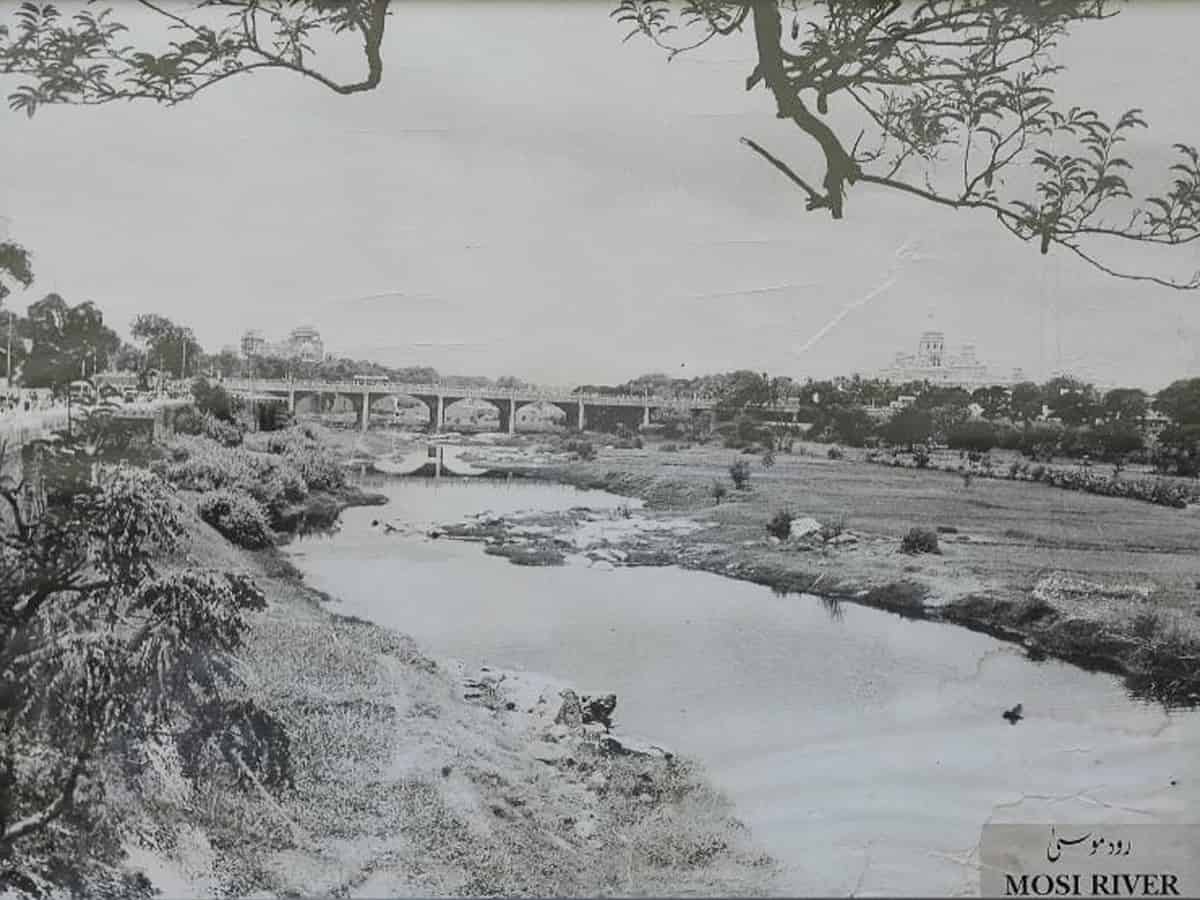
Heritage activist, Sajjad Shahid, gives a rational explanation to this saying, “The Musa and Musi are both identical in the Arabic, Persian and Urdu scripts. The only difference is the diacritical ‘alif’ and if omitted as is often done especially when written in Shikasta, Musa becomes Musi.”
History, Heritage and Hyderabad—the alliteration in this short phrase spells out the consciousness that is required to look at the existing well known locations and landmarks once again with renewed interest and vigour. The quietly flowing River Musi on the banks of which Muhammad Quli Qutb Shah, the fifth Qutb Shahi sultan, had founded the city of Haidarabad in 1591, deserves its share of deeper insight notwithstanding the know all position that all admirers of the Hyderabad city have. Being familiar with physical features of our land of habitation is one thing; it is entirely different to have a correct technical understanding of the subject.
The River Krishna branches out into many tributaries and we come to know through written records that two such tributaries, the Musa and Easa, that emanate in the Anantagiri hills near Vikarabad in the Rangareddy district 90 kilometres to the West of Hyderabad join the River Krishna near Wazirabad in the Nalgonda district. The River Musi, the Thames and Seine of Hyderabad, flows through the main regions of Hyderabad and separates the old city and the new city. River Musi was once known as the River Muchukunda and the Hussain Sagar tank was built on a tributary of River Musi.
It is also surmised by geographers and hydrographers who have studied the catchment areas of the Osman Sagar and the Himayat Sagar reservoirs that the Osman Sagar dam was built on River Musi in 1922 and the Himayat Sagar waters were dammed on the Musa in 1925. The dates may be conflicting going by other records but that is not what we are concerned with presently here. We need to understand this intriguing information that Musi was not always known as Musi but it was also known as Musa. In this multidisciplinary world of today what is the methodology used by the geographers, geologists and hydrographers that historians and heritage activists are not in the know of? Heritage activist, Sajjad Shahid, gives a rational explanation to this saying, “The Musa and Musi are both identical in the Arabic, Persian and Urdu scripts. The only difference is the diacritical ‘alif’ and if omitted as is often done especially when written in Shikasta, Musa becomes Musi.”
If we surmise that nuances of language could have been a reason that the name of Musa was confused with Musi, to some extent it can be said that geographers, hydrographers and geologists would not have given the language bit much thought but why did the British administrators who are known for their meticulous eye for detail call it River Musa? There are many references to the term River Musa in British administrative records.
While the geographers, hydrographers and geologists who work on ecology have referred to the Easa and Musa originating in the Anantagiri hills and these tributaries finally joining the Musi clearly draw a distinction between the Rivers Musa and the Musi. Even some geo-technical maps that have been prepared to facilitate future planning and development in and around the twin cities of Hyderabad and Secunderabad, refer to Rivers Musi and Musa as separate rivers. Published books dealing with urban geology of the twin cities of Hyderabad and Secunderabad, mineral exploration, records of the Geological Survey of India and the international journal of Advanced Remote Sensing and GIS give such details. “The Musi swerves towards north 2.6 kilometres SE of Gandipet and back to ESE 2.4 kilometres east of Gandipet. The Musa River flowing ENE follows a sinuous NE course from the locality 1 kilometre of Kismatpuram. It joins the Musi 1.6 kilometres WNW of Hyderabad.”
Interestingly, the colonial administrators refer to the River Musa alone. The earliest reference we see to the River Musa is in the Edinburgh Gazetteer, volume 3, which was written in 1822. Soon after, Alexander Stewart’s A Compendium of Modern Geography, Section on Asia, 1828, Edinburgh, describes Hyderabad as the capital of Golconda in Hindoostan situated on the south bank of River Musa.
The Encylopedia Britannica or Dictionary of Arts and Social Sciences of 1842 also speaks about the Musa River with reference to the fiscal duties imposed by the Nizam. The Report on the Sanitary State and Prospects of Trimulgherry in the State of Hyderabad, 1866 also refers to the city being built on the right bank of the Musa River, on ground that rises in height towards the south some parts seemingly being about 100 or 150 feet higher than the edge of the river bank.
The Proceedings of the Madras Government, Military Department of 1868 has a whole chapter on elevation and geology of Hyderabad and Secunderabad where River Musa finds reference again. A travelogue of Edward Ledwich Mitford written in 1884 also refers to the bridge built over the Musa River, a tributary of the Kistna; the streams and pools in its wide bed crowded with natives washing or drawing water. The Cyclopædia of India and of Eastern and Southern Asia by Edward Balfour, written in 1885 also refers to River Musa. In all of these citations, River Musa implies River Musi.
So to say, people at all points of time have used the name interchangeably, and it is only the earth scientists who have specifically differentiated between the Rivers Musa and Musi – River Musa being a tributary that joins the River Musi. Let’s also remember the French traveller Thevenot’s statement, “The river of Narva, i.e, the Musi, runs under that bridge (Pul-e-Narva) which then seemed to be but a brook, though in times of the rains, it be as broad as the Seine before the Louvre at Paris.”
Professor Salma Ahmed Farooqui is Director at the H.K.Sherwani Centre for Deccan Studies, Maulana Azad National Urdu University, Hyderabad.


