
Riyadh: The Kingdom of Saudi Arabia’s General Authority for Survey and Geospatial Information (GASGI) has released corrected historical aerial photographs from 1950 to 1980, showcasing various regions of the Kingdom.
The photographs depict the urban development, vegetation cover, and other transformations that have occurred in these specific areas.
The project showcases 164,484 images, providing a comprehensive record of the historical context of the locations, Saudi Press Agency (SPA) reported.


Here’s a look
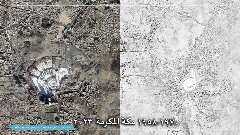
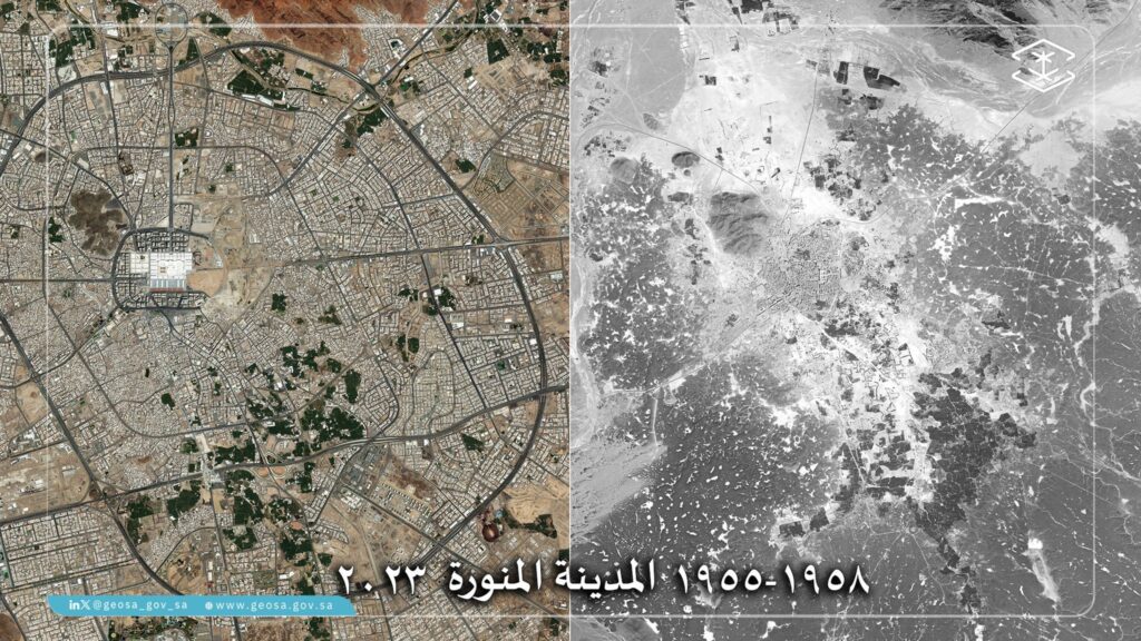
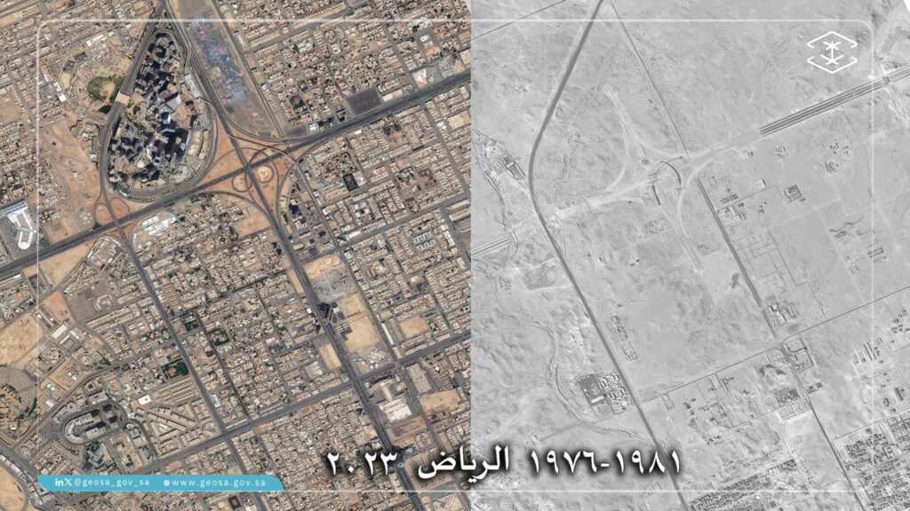
GASGI, in collaboration with various government agencies, processed and organized photographs based on region, year of production, and scale, aligning them with the reference coordinate system.
The project aims to analyze changes in urban and rural areas over time using corrected aerial images as historical references.
The project’s outputs are published on GASGI’s national geospatial platform, ensuring photographs are accompanied by legible digital coordinates.

It is noteworthy that the authority is working to organize, upgrade and supervise the surveying, geospatial information and imaging sector related to its work in a way that achieves quality and improves performance in accordance with international standards.